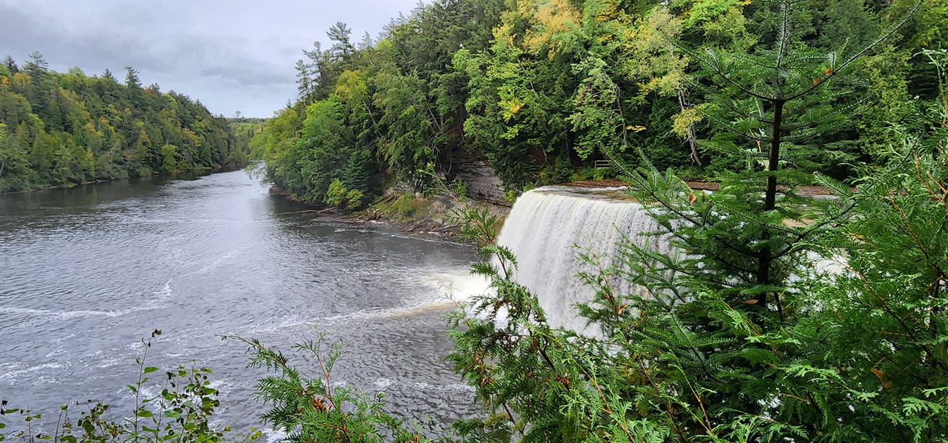
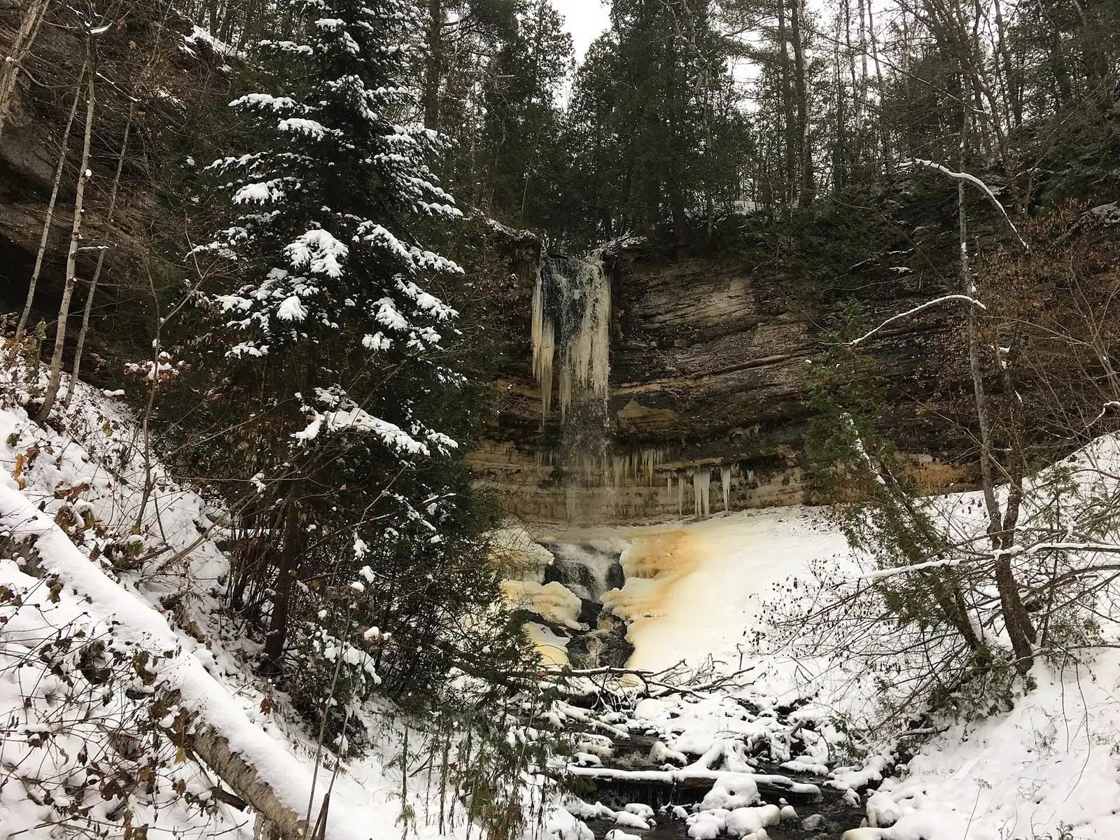
Upper Peninsula waterfalls change dramatically from season to season. Most are fed by snowmelt and rain, so they run strongest in spring and can thin out in dry summers. This guide explains when to expect good flow, how to check river levels yourself, and what to know about conditions before you drive to a falls.
When waterfalls run strongest
- Spring. UPTRA says melting snow and spring rain push U.P. waterfalls to peak flow, typically mid-to-late April through early May. Visit Keweenaw gives the Keweenaw an earlier window, mid-March to late April.
- Summer. Flow often drops. The National Park Service describes Bridalveil Falls at Pictured Rocks as a seasonal waterfall fed by snowmelt and spring rain that often slows to a trickle in dry summers.
- Fall. Flow depends on recent rain; color season is a good time to see falls framed by leaves.
- Winter. Many falls freeze. At Pictured Rocks, the NPS says ice formations typically begin to form by mid-December and last until early April.
Not every waterfall follows the pattern. Some, like Spray Falls, which the operator Pictured Rocks Cruises describes as the only spring-fed waterfall along the Pictured Rocks cliffs that runs year-round, are less seasonal.
Check river levels before you go
The U.S. Geological Survey (USGS) publishes real-time river measurements at streamgages. Two gauges relate to waterfalls on our site:
| Waterfall | USGS gauge | Note |
|---|---|---|
| Tahquamenon Falls | 04045500, Tahquamenon River near Paradise | USGS lists the site about 0.6 mile upstream of Tahquamenon Falls. |
| Bond Falls (Ontonagon River system) | 04033000, Middle Branch Ontonagon River near Paulding | Gauge is on the same river system; it may not match flow at the falls. |
For other rivers, use the USGS WaterWatch map for Michigan or NOAA’s National Water Prediction Service to find the nearest gauge and compare today’s reading with its recent history. Compare a gauge only with its own history; flow numbers differ widely between rivers.
{AD}Conditions that change the visit
- Trail and road status. Access can change. The NPS reports that the Munising Falls trail is temporarily closed after storm damage in April 2025 (as of the NPS waterfalls page last updated August 19, 2026). Check the managing agency before you go.
- Muddy and icy trails. NPS notes the Mosquito Falls trail can be muddy and rough, and roads to the Chapel Falls trailhead are primitive with potholes and washouts. Spring melt makes this worse.
- Stay on trails. NPS asks visitors to stay on trails and watch for uneven footing near falls; walking into or behind Munising Falls is prohibited.
- Pets. Rules vary by waterfall; NPS says pets are not permitted at all of them.
- Private land. NPS notes some U.P. waterfalls are on private land; be respectful and check ownership before you go.
How to plan a waterfall trip
- Pick your window using the seasons above (best time to visit).
- Check the nearest USGS gauge the day before, and the managing agency’s page for closures.
- Start with our waterfall hub, which lists falls by region, or use the waterfall playground guide.
- Bring waterproof footwear in spring and bug protection in early summer.
Frequently asked questions
When are U.P. waterfalls at their best?
UPTRA says typically mid-to-late April through early May, and Visit Keweenaw puts the Keweenaw’s best viewing from mid-March to late April.
Where can I see how much water is in the river?
The USGS publishes real-time streamflow at streamgages, including the Tahquamenon River near Paradise (04045500) and the Middle Branch Ontonagon River near Paulding (04033000).
Do waterfalls dry up in summer?
Some thin out considerably. The NPS says Bridalveil Falls often slows to a trickle in dry summers.
Sources
- Michigan’s Upper Peninsula Travel & Recreation Association, Michigan’s Waterfalls in Spring.
- Visit Keweenaw, Waterfalls.
- National Park Service, Pictured Rocks National Lakeshore, Waterfalls (updated August 19, 2026); Winter Activities.
- Pictured Rocks Cruises, Tickets & Schedule (Spray Falls).
- USGS Water Data: 04045500; 04033000; WaterWatch. NOAA, National Water Prediction Service.
- Hours, fees, road conditions, and access change — verify with the managing park or visitor bureau close to departure.
- Cell service is thin across much of the peninsula. Download offline maps and tell someone your route.