Piers Gorge
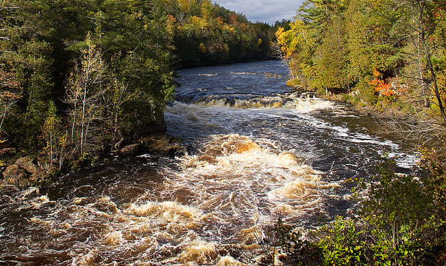
Piers Gorge is a beautiful gorge that has been formed by the Menominee River. It gets its name from the drops that look like “piers” as they fall over rock ledges. These create four sets of rapids. The biggest of the drops is about 8′ high and is named Mishicot Falls.
There is a nice hiking trail that runs alongside these ledges and drops. It is well-maintained and runs 1-2 miles up the river. The first and second piers are located a short 1/4 mile hike upstream from the parking lot. After these is the largest drop, Mishicot Falls. There is a nice overlook high above the falls, and you can also get down close to the water if you wish. The last of the Piers is located about 1 mile upstream from Mishicot Falls. This drop is called Sand Portage Falls.
Piers Gorge is also a popular whitewater rafting destination. View some local rafting companies below:
Piers Gorge is located at the end of Piers Gorge Road, west of US 8 just north of the Michigan/Wisconsin border. There is a large shaded parking area at the trail head. Please look at the map below to find the trailhead.